
Fine Art Printery
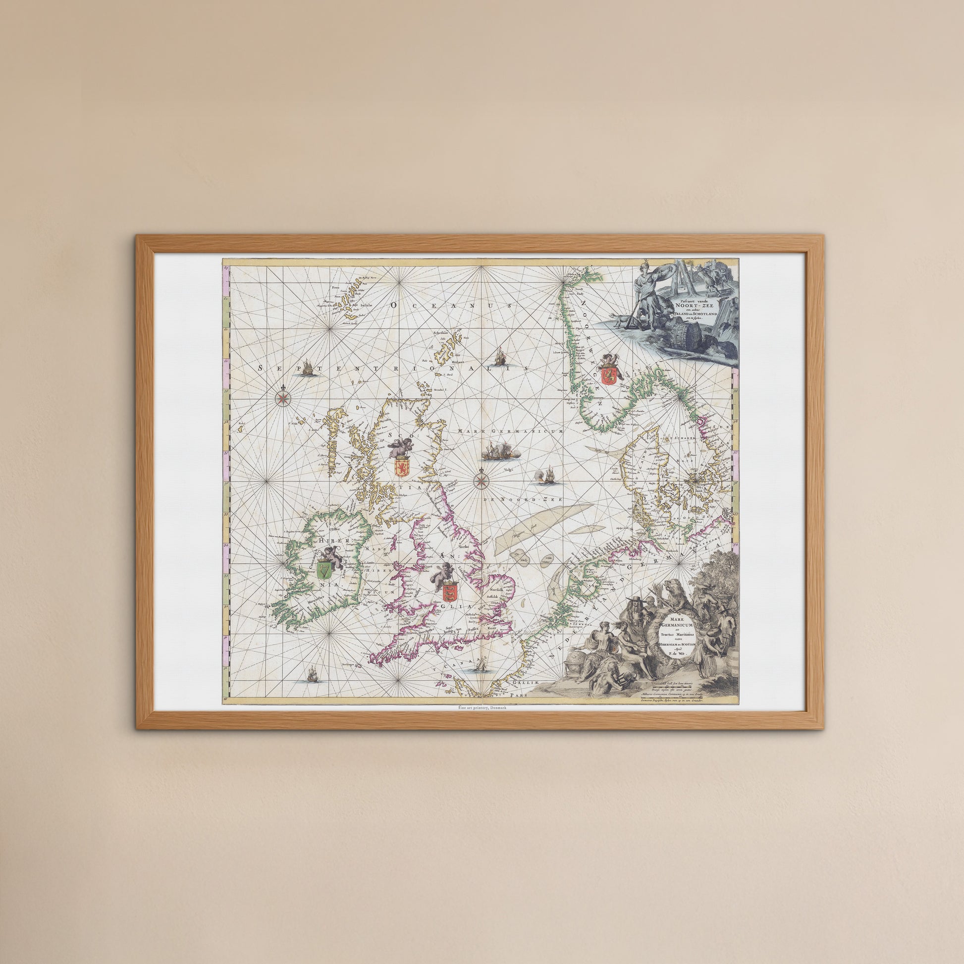
Historical Nautical Chart "Mare Germanicum" by Frederick de Wit (ca. 1690)
Historical Nautical Chart "Mare Germanicum" by Frederick de Wit (ca. 1690)
unless otherwise mentioned in the product description, frames etc. in the pictures are for decorative purposes only and are therefore not included.
Couldn't load pickup availability
Take a journey back in time with this magnificent, hand-colored nautical chart. "Mare Germanicum ac Tractus Maritimus retro Hiberniam et Scotiam" by the famous cartographer Frederick de Wit is more than just a map; it is a work of art and a testament to maritime history. Originally created around 1690, during the Dutch Golden Age, this map was an indispensable part of navigational literature and a symbol of the advances in cartography of the time.
The map covers the waters around the North Sea (Mare Germanicum), stretching from Scotland and Ireland in the west to the coasts of Denmark in the east. Every detail tells a story: the precise coastlines, the fine navigation routes (also called compass lines), and the many cities and heraldic coats of arms that mark the different regions.
What makes the original on which this print is based so extraordinary is its artistic quality. The decorative elements, including the detailed cartouches, are executed in the unique grisaille technique , which uses varying shades of gray to create the illusion of depth and sculptural relief. This technique was an artistic highlight of the period and gives the map a sophisticated and timeless aesthetic. The rich blues, greens and golds of the rest of the map highlight the geographical areas and coastlines, making it both functional and beautiful.
This poster is the ideal choice for history enthusiasts, sailors, travelers, and collectors of unique and historical maps. Hang it in your living room, office, or library and let it serve as a conversation starter and a tribute to a bygone era of exploration and great maritime feats.